


Delaine Voting District, Sumter County, South Carolina
About
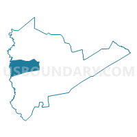
Outline

Summary
| Unique Area Identifier | 666834 |
| Name | Delaine Voting District |
| County | Sumter County |
| State | South Carolina |
| Area (square miles) | 42.51 |
| Land Area (square miles) | 42.13 |
| Water Area (square miles) | 0.38 |
| % of Land Area | 99.11 |
| % of Water Area | 0.89 |
| Latitude of the Internal Point | 33.91919220 |
| Longtitude of the Internal Point | -80.55224910 |
Maps


Graphs
Select a template below for downloading or customizing gragh for Delaine Voting District, Sumter County, South Carolina


Neighbors
Neighoring Voting District (by Name) Neighboring Voting District on the Map
- Eastover Voting District, Richland County, SC
- Horatio Voting District, Sumter County, SC
- Manchester Forest Voting District, Sumter County, SC
- McCray's Mill #1 Voting District, Sumter County, SC
- Oakland Plantation #2 Voting District, Sumter County, SC
- Shaw Voting District, Sumter County, SC
- St. Paul Voting District, Sumter County, SC
Top 10 Neighboring County Subdivision (by Population) Neighboring County Subdivision on the Map
- Sumter CCD, Sumter County, SC (50,528)
- Shaw AFB-Horatio CCD, Sumter County, SC (21,960)
- Eastover CCD, Richland County, SC (5,433)
- Sumter Southwest CCD, Sumter County, SC (4,188)
Top 10 Neighboring Place (by Population) Neighboring Place on the Map
- Sumter city, SC (40,524)
- Cherryvale CDP, SC (2,496)
- Wedgefield CDP, SC (1,615)
- Cane Savannah CDP, SC (1,117)
Top 10 Neighboring Unified School District (by Population) Neighboring Unified School District on the Map
Top 10 Neighboring State Legislative District Lower Chamber (by Population) Neighboring State Legislative District Lower Chamber on the Map
Top 10 Neighboring State Legislative District Upper Chamber (by Population) Neighboring State Legislative District Upper Chamber on the Map
Top 10 Neighboring 111th Congressional District (by Population) Neighboring 111th Congressional District on the Map
Top 10 Neighboring Census Tract (by Population) Neighboring Census Tract on the Map
- Census Tract 18.02, Sumter County, SC (7,845)
- Census Tract 17.01, Sumter County, SC (6,736)
- Census Tract 120, Richland County, SC (5,433)
- Census Tract 17.03, Sumter County, SC (4,833)
- Census Tract 18.01, Sumter County, SC (4,188)